
Chitteri
Chitteri is located in Pallikaranai. It's a neighborhood and a fast-growing residential area. The suburb has experienced rapid development with the advent of IT companies along the Old Mahabalipuram Road. Chitteri is surrounded by mixed residential areas. The main source of water supply to the lake is from Periya eri. This water reaches the lake through the drain which was encroached by numerous houses in the residential area. The present surplus course is along the southern end and runs nearly 600 m to join the junction of marshal land. The pond has been restored under the Chennai Smart City project funds.
AREA: 76890.34 Sq.mtrs ZONE: 14 DIVISION: 190
The pond is located at North Latitude 12.932265 and East Longitude 80.2060033. Kovalan Nagar, Pallikkaranai, Chennai Tamil Nadu 600100
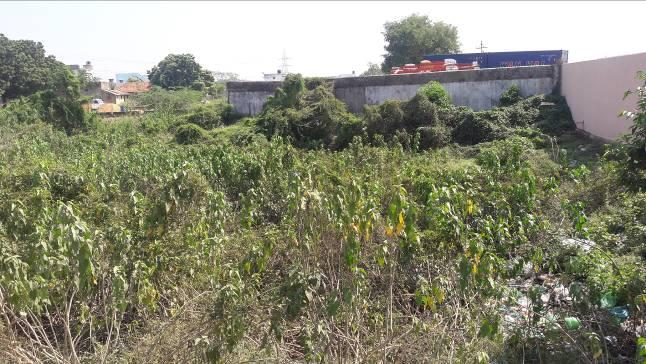
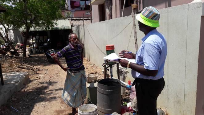
The pond is roughly rectangular in shape. There is no water in the pond during the time of survey. The pond has no steps, revetment, inlet or outlet. It is dumped with minor amount of solid waste and liquid waste from the restaurant opened recently in the nortern side along the main road. The soil is sandy in texture favouring good percolation of the stored water. The water spread area is infested with water hyacinth. Encroachment is observed along the bund of the pond. The pond needs immediate intervention to save from further encroachment. Shallow water table exists in the area. Shallow wells and borewells are the common groundwater extraction structures in the area. The community feels that the pond act as a major recharge source to their wells and borewells.
Based on the Google Earth output, it is inferred that the total area of the pond is 6392.6 sq.m and the total length of the bund is 270m. The average depth of the pond is about 2m
The imagery extracted from google earth on 21.03.2016 and 01.06.2002 is presented below. Even though no major changes could be detected, at ground, encroachment is happening on the northern bund and also liquid waste is diverted into the pond.
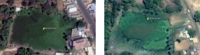
Google Image of the pond as on 21.03.2016 (LEFT) and 01.06.2002 (RIGHT)
As total station was not done to this pond the exact extent is not available and hence run off model was not generated to this pond.
Based on the field observation and inferences, following were the list of activities proposed for renovating the pond
- To start with, the pond can be desilted and deepened.
- The bund need to be formed and strengthened;
- Revetment need to be provided with toe wall and binding wall along with steps.
- Bush clearance all around the pond and provision of a pathway all around the pond to a width of 1.8m and properly fenced.
- Bush clearance all around the pond and provision of a pathway all around the pond to a width of 2m and properly fenced.
- A recharge well of 1.2m in diameter to a depth of 3m can be provided in the pond to facilitate groundwater recharge. Also a diversion from the existing storm water drain into the pond ca be provided